2012. július 26., csütörtök

Türkmén jurta


1480. oldal

831. más jurták

2 IV 2 s Turkomen (Taurus Turkey, sc)
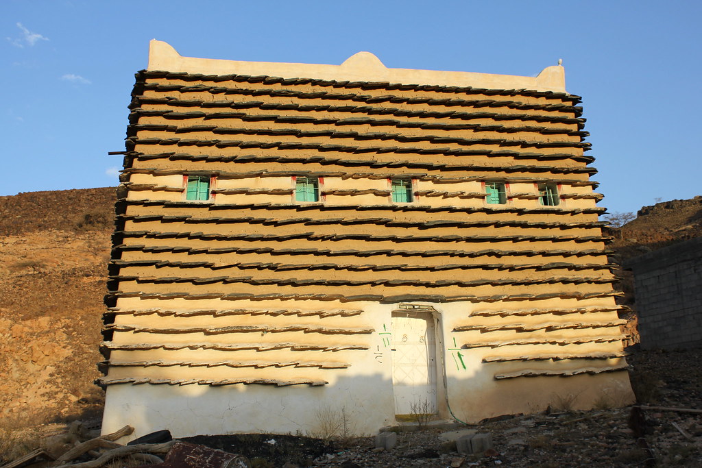
The Turkomen are the great part of the nomadic Turks who came from Central Asia to Anatolia between the nth and 14th centuries and who were not sedentarized In the Taurus mountains of the Mediterranean coast, some of the Turkomen have survived until today in spite of an accelerated shift to agriculture and other professions since the 19505
The lurks brought their Central Asian yurt-type tents to the central regions of Anatolia where they first settled because of the geographical resemblance to their native countries The

yurt is suitable for the harshness of central Anatoha's chmate, but Its permeable felt cover makes the dwelling inappropriate for Its region's higher rainfall Ihis fact must have played an important role in the rapid process of sedentarization in central Anatolia On the other hand, the efficient and sophisticated form of the yurt has svmbolic values which suggest remembrance of the past For that reason, in central Anatolia though the nomadic life disappeared centuries before the use of the yurt as a summer shelter or for ceremonial purposes (eg as a wedding tent) has continued until today in, for instance, Emirdag near Afyon, and Bor and Ulukisla near Nigde)
As the climate is mild in the subtropical area between the Taurus mountains and the Mediterranean Sea, the protective advantage of the vurt against the cold is not required and the nomads preferred the black tent which can be produced without any craftsmanship transported easilv and constructed quickh 1 his tent is am and its cover is waterproof since it is woven of goat hair which is spun without having been washed and is then swelled by rain
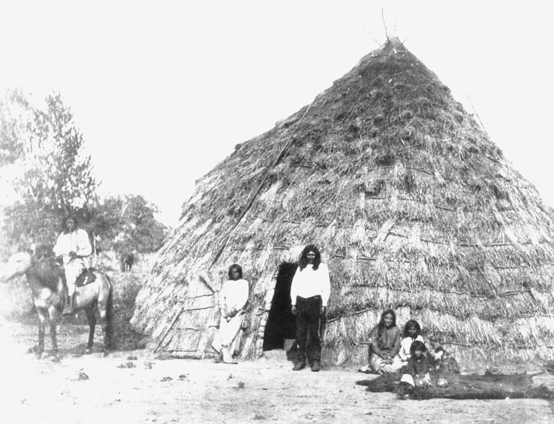
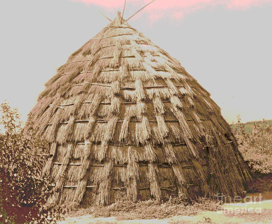
The term 'yurt' is Turkish and means 'homeland' in Anatolia, the term topakeu, domed house is used instead The topakeu has the same characteristics as the yurt of the lurkoinen Uzbeks and latars of Central Asia Ihe terms used for different elements of the topakeu are common with those of the Turkomen of Horasan
Ihe yurt is a portable framework formed by half-split willow rods which supporta felt tent cover Ihis framework consists of
a cylindrical trellis wall and a dome-shaped roof The trellis wall, constructed with rods criss-crossed over one another with hinged joints of pegs, is approximately i i m {3 5 ft) high and is made of four sections or more, which can be folded up Ihis system makes the walls portable and the diagonal direction of the slats increases the strength and stabihtv of the walls For the construction of the yurt, the sections of the trellis wall are placed side by side in order to make a cylindrical form, and bound together Between two of these sections is set a doorframe 1 hen a 3 m (10 ft) high pole is erected in the centre of the cylindrical wall which supports a roof wheel (dügnük) roughly I. 3 m (4 .3 ft) in diameter The rim of the roof wheel is pierced with two rows of slots the upper row for the rods which strengthen the circular form of the rim, while the curved roof poles (çig) which tie the wheel to each set of crossed rods at the top of the wall, end at the lower row of slots
The framework is covered with white felt made of sheep's wool For the cylindrical part a long rectangular felt is used, while the roof has two crescent-shaped felts and the top has a circular piece During the extremely cold winters the layers of felt can be augmented The felt cover of the vurt is wrapped around by woven tension bands which strengthen the whole construction It is not necessary to bind the vurt to the ground with rope and stakes, which is an advantage in geographical
areas with frozen ground. The central pole can be removed after the construction process, and replaced by a fireplace. The roof wheel above can be left uncovered to function as a smoke-and light-hole.
The aerodynamic form of this tent type increases its resistance against the wind. IVlaximum volume is obtained by minimum surface. The semispherical interior gives an impression of more space, in comparison with any other geometrical forms of the same base area. The concave inner surface and the white light of the translucent felt mediates the severity of the external conditions. The black tent that the Turkomen met in their migration to the west is the tent t\'pe which is widespread among the recent nomads (the last nomadic groups of Anatolia) of the Taurus mountains. What is interesting is that the black tent of the Turkomen is closer in form to the Arabic tent than to the Persian one which they had encountered on their way to Anatolia.
The felt used in the yurt is not resistant to tension. However, the flexible web of the black tent does not necessitate an extra framework. Its whole structure consists of only the web. The five to seven or more cloth breadths approximately 60-80 cm (2-2.5 ft) wide and 4.5-g m (15-30 ft) long, woven of black goat wool sewn together along their longitudinal length, make a rectangular cover. This cover cannot be pulled on its long sides, as the seams can be ripped. That is why, along the two short sides and between and parallel to them, tension bands 15 cm (6 in) wide are sewn on the cover. These bands are placed perpendicular to the breadth of the cloth, and are pulled with ropes at their ends to get the cover tight.
In addition, the tent is pulled with a stretch rope at the mid-
dle of each side. For the elevation of the cover, poles 2-2.3 "^ (6.5-7.5 ft) high placed in the middle of the tension bands are used. The central pole is higher than the others. The verticality of these poles is obtained by the tension of the bands. After the cover has been tensioned, the flanks of the tent are surrounded by a more loosely woven web (sitil). This web is attached to the cover by means of wooden pins and can be removed for ventilation; during cold days, a bare stone wall is built around it.
On the floor of the tent, woven mats (kilim) and felts are laid. And as in the yurt, sacks of grain and items of daily life are lined up adjacent to the walls of the tent. The woven sacks, which are richly ornamented and coloured, create an attractive interior ambience.

Türkmén jurta_szov1480_82.txt

ing wooden framework of latticework panels (trellis), roof struts, a roof wheel or roof ring, and a door-frame with or without a door leaf; a felt covering; and woven bands and ropes made of wool and cotton which hold the wooden structure together and fasten the felt covering. It is closely associated with sheep breeding as wool is necessary for the felt covering.
Rock engravings dating back to the second and the first centuries BC and discovered in the middle Yenisey basin (Siberia) show herdsmen, their sheep and cattle, their large log huts and their yurt-like dwellings. As a result of the Turko-Mongol migrations of the ijthcentur)', the area where the yurt was used extended westwards and it is now found in a 1500 km (930 mi) wide, 7000 km (4300 mi) long territory stretching from Mongolia and southern Siberia to Turkey; it has very few variations in form and detail within this area.
Yurts are roughly divided into two main cultural types: the Mongol-type yurt with its straight struts, and the Turkish-type yurt with its struts bent on the lower half which give the top of the yurt a rounded or flattened appearance.
The yurt IS used by all nomadic Mongol and Turkish peoples. In northern Afghanistan some Tajik, Hazara and Aymaq groups culturally influenced by their I'urkish neighbours have adopted it. Today it is still the permanent or temporar)' dwelling ofhundreds of thousands of nomadic herders and of numerous semi-nomadic agro-pastoralists. In Soviet Central Asia, the yurt, once condemned as retrograde, was rehabilitated at the time of Khrushchev for its practical advantages: mobilit)' and climatic adaptability, for the brigades of herders.
The curved trellis is composed of four or eight separate elements (when eight elements, they are superimposed in pairs) set in a circle; the trellis and the door frame with its vertical elements form the walls of the dwelling, while the trellis and the
uprights are the vertical carrier elements. Broad woollen girths encircle the trellis and prevent it widening under the weight of the roof
Roof struts (40-100 depending on the size of the yurt) join the top of the trellis and the lintel to the rim of the roof wheel. The length of the struts ranges between 2 m (6.5 ft) and 2.8 m (g.2 ft). The lower tips of the struts are tied up on the top of the trellis; the upper ones, sharpened to a taper, slot into the holes oftheroofwheel. In order to link and maintain the struts firmly at equal spacing, and to keep the dome stable, the struts are fastened by each one being tied around with a woollen home-woven ornamental band; this counterbalances the force of vertical pressure caused by the dome and transmitted by the struts.

The roof wheel has two or more bundles of curved spokes that span the wheel.
The yurt is covered with large pieces of felt trimmed with ropes and girths: two trapezoid felts over the struts, four rectangular felts around the trellis and a top felt that can be folded back to open a smoke-hole and skylight, and closed to prevent snow and wind from entering.
The wooden carcass is made by village carpenters. The wood-willow or poplar - cut green - can be bent easily; the carpenter cuts the laths of the collapsible criss-cross wall units; a hole is made through each wooden piece where it crosses another, and rawhide, working as a hinge, is passed through the holes and knotted on both sides. The trellis can be folded accordion-like.
The other elements of the yurt-felt, girths, ropes, inner and outer decoration - are made within the family of the herders, generally by the women. The felt is made with sheep's wool sheared in the late summer.
Erecting and dismantling of the yurt is women's work; the men will help to lift up the heaviest parts - the wheel and the roof felts. Pitching takes about two hours. The wooden part can last 50 years, the felt between 7 and 12 years.
Unlike the tent, the yurt supports itself With the same inhabitable volume, it is however, much heavier; the wooden framework weighs up to 150 kg (330 lb) and the felt covering at least 100 kg (220 lb); when moved from place to place, it is transported on two camels or three horses.
Its squat form and its thick covering suit harsh and windy climates as those of the Pamirs and of Mongolia. In extreme cold, the felt covers the trellis down to the soil; in summer, side felts are raised for aeration. Otherwise, in milder climates or where the yurts are used only during spring and summertime, the felt covers only half the trellis and the 'walls' are covered with cane screens.
Through external distinctive marks, such as for instance white cotton girths on the dome (Uzbek), appliqué or embroidered motifs (Kirghiz), a carved door (Turkmen), it is possible to identify the ethnic group, the region, and even the family and its wealth. The interior of the yurt is divided according to strict rules by all peoples using it.
The term 'yurt' (Turkish) adopted by European languages for this dwelling is in fact employed in this sense by none of its users; rather the term refers to the soil, to the place where the 'yurt' is built, to the camp, to the territory occupied by the same clan, and by extension, to the home country. For the iVlongolians, the proper term is^qcr; in Turkish, it is called uy, oy, uy, ortopakcu; in Persian, kheríjáh or simply kliätie/klidna, house, and in Russian literature, kibitka.

Türkmén jurta_szov mas832_33.txt

Ingus lakótornyok, Guli környékén


1430. oldal

http://goo.gl/maps/hFvoA

http://wangfolyo.blogspot.hu/2010/10/nemzetsegi-tornyok.html
http://zyalt.livejournal.com/313843.html

http://tywkiwdbi.blogspot.hu/2010/11/clan-towers-of-ingushetia.html
http://blogs.karthik.asia/2011/04/family-towers-in-ingushetia.html
http://www.secularcafe.org/showthread.php?t=11343&page=12

2 11110g lngush(Chechnya w Ingushetia Caucasus c)
The Ingush live in the foothills and lowland areas, and also in the deep valleys of the central Caucasus In the igth and 20th centuries their principal occupations were animal farming in the mountains and crop farming in the plains
Old Ingush villages were on steep mountain slopes and at the bottom of deep secluded ravines Often villages ofanything between 6o and go farms were largely composed of members of a single patrilineal clan Some families occupied several
villages in the same vicinity. Nearly all villages had their defensive towers, inhabited towers and in some cases their watch-towers The common type of dwelling was a two-storev stone house with the lower floor housing livestock and the upper floor used as a habitation and workshop By no means all had guest accommodation, but if they did it was a separate building a little apart from the house and it generally comprised a living-room and a lobby In the communal room, usually against the back wall, there was a hearth for heating and cooking, with a chain for the cooking pot suspended over it To the right of the hearth, along the side wall there was a long bench and at mealtimes low three legged round tables were set out in front of this bench The best tableware - pewter and glass - was kept on show in this room in a special niche
Prevalent among the Ingush were three-storey tower dwellings which housed the numeious members of their extended families The tower had a single entrance on the ground floor which was sealed with an oak door or a stone slab In the tower walls there were a few small slit windows which could be sealed with double-batten shutters The lower floor housed the livestock, while the upstairs floors were living-quarters Each family had its own quarters, shut off from the others bv blank walls and each had its own separate access I here were, however, trapdoors bv means of which members of the family could communicate with each other Ihis sort of tower house was a reliable defensive structure In the event of danger it made an impregnable fortress
Very often tower dwellings were built close to defensive towers and enclosed by a common high stone wall Castles like these are found not only among the Ingush but also in Ossetia, Chechnya, Dagestan and other mountainous regions of the Caucasus
When they settled in the plains in the iSthand igth centuries, the mountain dwellers adopted the Cossack-type house of their neighbours Originally most Ingushi adopted their own version

of the Cossack hut (mazánka), a small wattle and daub house comprising two rooms and a lobby with a thatched gable roof Subsequently, this grew into a longhouse built of unfired brick with a gable or hipped roof which was either thatched or tiled The walls were plastered inside and out with lime-mortar This type of house had three, four or five rooms, each with its own door giving on to a narrow covered veranda which ran the entire length of the house under a common roof This type of dwelling usually housed a large family with married sons each having a separate room and the head of the family with his wife and children living in the communal room which also served as the kitchen In the central section of the house, next to the communal room, there was a guest-room
For heating and cooking there was a fireplace with a chimney-stack, usually against the back wall of the communal room Other rooms were generally heated bv a Russian tin stove As well as the longhouse, in the plains of Ingushetia there were rectangular stone or timber houses with rooms interconnecting as they did in the town

Ingus lakótorony_szov1430_30.txt

Palloza, Piornedo, Galicia, Spanyolország


1533. oldal.

http://goo.gl/maps/Vxp7p

http://en.wikipedia.org/wiki/Palloza
http://r3---fra07t16.c.bigcache.googleapis.com/static.panoramio.com/photos/original/4833745.jpg?ms=tsu&mv=m&mt=1343329682&cms_redirect=yes&redirect_counter=2
http://pt.bestpicturesof.com/pallozas
http://www.cienladrillos.com/2007/05/29-pallozas

2.IV.5J-I Galician: palloza
A dwelling of oval or circular layout and with a thatched roof, the palloza is preserved in the remotest parts of the eastern mountains of Galicia, in the northwest region of the Iberian peninsula.
The biggest concentration of pallozas is found in the villages of Vilarello, Xantes, Donis, Piornedo and Moreira, about 1200 m (4000 ft) above sea level, in the western band of the Sierra dos Ancares which runs from north to south between the provinces of Lugo and Leon. Outside this area the remaining pallozas are rare, surviving in an adapted or evolved fashion. They are found on the sunniest mountain slopes forming groups of dwellings along a stone road (corredoira) which follows the curve levels. This pattern of settlement, called rueiro, is the commonest in the region.
There is a wide range of ground plans from the almost circular to the almost rectangular with round corners. This diversity responds to climatological conditions such as the direction of the prevailing winds, constructional ones like the length of the structural elements, or functional ones such as the need for bigger space.
Generally the size varies between 12 m (39 ft) and 14 m (46 ft) in diameter. The major axis in the plan follows the direction of the slope allowing two levels inside the dwelling. While the highest is occupied by the family members, the lowest serves as shelter for cows and horses. Basically, the palloza is a huge single space under a big straw cover which shelters people, animals and the harvests against the long harsh winter. Its shape is similar to that of an inverted hull lying on a 2 m (6.5 ft)-high

laid over it On the barra rye straw, hay and potatoes are stored to help to last out the winter The barra also provides extra sleeping space Above the lareira and across the astraijo extend two horizontal beams igansenas] holding a t>pe of platform the camzo with a twofold function to protect the thatched roof from sparks and to serve as a place for drying chestnuts, an essential part of the diet
I he roof structure made of oak or chestnut timber, comprises two wooden poles (esteos or pes de armar) placed upon a large stone perforated in the middle I he> are forked at the top to hold the main beam (cume) which serves in turn to support the rafters {cantos) Above these the horizontal planks (iatas) hold the straw trusses (colmos) To help to support the weight there can be auxiliary beams (carreiras) which run horizontally and are supported by tixeiras, small esteos which are placed near the walls
Ihe last residents in this type of dwelling left the palloza do Perdyon in Piornedo in iggi Most of them are, however still used for sheltering the animals

Palloza_szöv1533_34.txt

2012. július 25., szerda

Számi lavvu


Tutaj ház, Belen, Peru


Könyvben nem kerestem még.

http://www.flickr.com/photos/pierre_pouliquin/473097437/
http://www.flickr.com/photos/pierre_pouliquin/522523339/in/photostream/
http://www.flickr.com/photos/pierre_pouliquin/sets/72157594375583376/with/522523339/
http://dawnontheamazon.com/blog/2010/05/07/lets-go-on-a-day-trip-with-dawn-on-the-amazon/
http://www.flickr.com/photos/pierre_pouliquin/313816062/
http://bubuiainstitute.files.wordpress.com/2010/10/houseboats_iquitos_peru_feb_2002_1.jpg
http://www.flickr.com/search/?q=belen%2C%20peru
http://www.flickr.com/photos/mywayaround/sets/72157623270105990/with/5207628025/

http://goo.gl/maps/DhMa

Wichita fűkunyhó


(apacs fűkunyhó és wigwam helyett)

1894. oldal, csak kép.

Van caddo fűkunyhó is. 1879. oldal, csak szöveg.

http://www.native-languages.org/houses.htm

Wichita:
http://nothing-is-new.com/wp-content/uploads/2010/12/Wichita-grass-house.-Date-Created_Published-c1927.jpg
http://lcweb2.loc.gov/service/pnp/cph/3c10000/3c18000/3c18500/3c18599v.jpg
http://plainshumanities.unl.edu/encyclopedia/figures/800/egp.na.127.jpg
http://images.fineartamerica.com/images-medium-large/wichita-grass-house-padre-art.jpg

Caddo:
http://www.texasbeyondhistory.net/kids/houses/grass.html
á, ez még reménytelenebb...

3.VI.5.t Wichita (OK)
A Caddoan-speaking people of possible Arkansas origin the Ousita or Tawakoni are known by the name given to them by the Choctaw, a Mississippi people of whom some moved to Oklahoma. They were called w\a chitoh, or 'big arbour', in recognition of their large houses. The Wichita were an agricultural people who traded with the Plains Indians from whom they adopted the skin tipi for war or hunting expeditions. An alliance with the Comanche against the Osage led to several decades of unrest and considerably reduced numbers. They returned to the Indian Territory (later, Oklahoma) to divide up their land between the five hundred or so survivors.
The 'big arbour' of the Wichita is a large, grass-covered undifferentiated structure which has been noted by explorers since Coronado's expedition report of 1541. This described the houses of the Quivira (the Wichita) in present northeastern Kansas: 'the houses which these Indians have were of straw, and most of them round, and the straw reached down to the ground like a wall' (Bushnell). The Wichita 'grass house' as it has been commonly termed, was built and used until the 1940s, and occasionally later. The ground was prepared by the women,
ciearea or grass ana levelled. A circle was arawn on rnc grouna by the customary means of a stick and rope, and four branched logs or crotches of cedar cut by the men were driven into the ground at the cardmal directions. Other forked posts completed the circle, and horizontal log beams were laid between them and lashed in place.
Four groups of men each sought a long cedar pole, the trees being addressed with an invocation. These were again placed cardinally and tied; further long poles of elm or hemlock, sometimes split, were laid against the framework, placed close together and bound into position with rawhide thongs. Willow rods or osiers were laced horizontally around the structure, securing the inward-curving poles. The upper levels, where the leaning poles were thinner, were drawn taut with a tension ring of twisted grapevine, making the whole a tensile structure. In earlier times four round-headed door openings were provided, but by the late-igth century many houses had two only. One faced east and was used in the morning, the other was opposite and faced the setting sun.
There was no supporting central pole but above the centre at the meeting of the pole frame a cruciform of the first longer and sharpened poles pointed to the four cardinal directions, by which spiritual powers were gathered to help the occupants. According to Fletcher, a separate cruciform was constructed for this purpose. Before thatching, a prayer of dedication to Kin-nikasus, the supreme supernatural being and creator, the 'Man Never Known On Earth', was off^ered here (Curtis). The whole structure was thatched with a thick layer of prairie grass, which was tied to the horizontal rods, a notched log ladder being used when attaching the grass from the inside, the thatchers on the outside standing on the rods of the frame. The thatch was secured in place by further rings of willow rods. Where the rods crossed the leaning poles, thick bunches of grass were tied, producing the deeply ribbed texture evident in early photographs of the Wichita houses. The grass bunch ribs were omitted from some later houses.
On top of the four crossed poles a finial was erected of grass bunches tightly tied and secured to the cross, which symbolized 'the abode in the zenith of the mysterious permeating force that animates all nature' (Fletcher). Below was the fireplace, considered sacred and treated with reverence. A small opening to the east of the crest finial permitted the escape of smoke from the fire. The beds or sleeping couches were made of frameworks of light poles, sometimes integral to the

Wichita_szov1894.txt

2012. július 23., hétfő

Ema (uma), Közép-Timor, Indonézia


1090. oldal

http://www.seasite.niu.edu/easttimor/indigenous.htm
http://epress.anu.edu.au/austronesians/inside/mobile_devices/ch06s11.html
http://www.sumai.org/asia/atoni.htm

2 11.2 f Ema (Timor, c)
The Ema, a sedentary farming people of central Timor, live essentially in villages in hilly country. Their houses are built on stone terraces which allow fast and safe draining even in torrential rains. There are two types of building: the house (uma) and the granary (lako), whose enclosed upper part is used to store grain, other foodstuffs and objects such as musical instruments. The open lower part serves as a meeting place, a workplace for the women and as a place to put up guests during ritual ceremonies.
Both the houses and the granaries are built on piles, on which rest the wooden beams which form the supporting frame of the house floor. The floor is built in two parts: namely, the entrance and a large all-purpose room separated from it by a wall made of planks fitted in between wooden posts. A single wooden door opens through this 1.8 m (6 ft) high wall. It is usually adorned with two sculpted breasts, a buffalo horn and carved spirals. The three other walls of the room are made of vertical bamboo laths which are held in place by wooden crossbars running through the posts. The whole of the house floor is sheltered by a roof thatched with Itnperata cyimdrica, which nearly reaches the ground. The roof structure is supported by a mast resting on a crossbeam, itself supported by two posts, one 'male' and one 'female', which are embedded in the eastern and western walls of the house and planted in the ground. The upper ends of these posts form tenons which fit into mortises at either end of the crossbeam. The roof therefore rests on a beamwork of horizontal and vertical frames fixed on trusses.
All houses are built according to the same plan. They vary only in size, workmanship and the shape of the roof The roof is either circular or oval in plan (in this case with a ridge). A urban Dutch house stairway leads from the terrace through an opening in the low mside wakaiiar fort roof to the entrance and to the door, which opens into the single square room. The room is divided into two areas, one female (on the side of the 'female' post) and one male (on the side of the 'male' post). The 'female' area, which is the smaller one, contains a hearth with five stones - the 'mother' and her four 'children' - over which hangs a wooden lattice used to store dry goods. The sacred objects of the house are kept in the bigger 'male' area.
Although all houses are built according to the same plan, they differ by their status. The lineage house, built within the limits of the ancestral villages, which are located nearest to the hilltop, symbolizes the unity of the group that claims descent from a founding ancestor and original builder of the house. It is called a 'sacred house' for it contains the heirloom of the ancestors and the various objects required to perform the ritual. The building or rebuilding of a lineage house is surrounded by numerous rituals which run for a period of several months. Elder and younger brothers, whether biological or classificatory, who can claim to be part of the lineage of the founding ancestor of the house, take part in these rituals together with their wife-takers

and wife-givers. The most important ritual is the one that accompanies the physical completion of the building and also makes it symbolically complete. This ritual gives rise to a great feast called 'eating the house' which can gather over a hundred people. Animal sacrifices, fecundity rites, invocations of ancestors, distributions of food and ceremonial exchanges between the members of the house and their wife-takers and wife-givers take place during the feast. Thus, on the occasion of the rebuilding of the lineage house every ten years or so, the cohesion of the group is reinforced while its relationship with its affines is reaffirmed.

Ema_szov1090_91.txt

Niha: ewali, Dél-Nias, Indonézia


1119. oldal

http://goo.gl/maps/pTIJO (talán)
http://www.indonesiatraveling.com/images%20nieuwe%20opzet/Sumatra%20Pics%20WM/N-Sumatra-Nias%201600%20.jpg

http://www.sumai.org/asia/nias.htm

2 11.3 k NJha: ewali(Nias, s)
The island ofNias lies 120 km (75 mi) westofSuma-tra, in the Indian Ocean, at about 100 km (62 mi) north of the Equator. It is part of a string of islands marking the western limit of the Indonesian archipelago. Its surface is 4475 sq km (1745 sq mi).
Nias island has a mountain range about 500 m (1650 ft) above sea level, running northwest to southeast; the highest altitude of the island is 8go m (2920 ft) above sea level. Most of the area consists of hilly land, with alluvial plains limited to the coastal areas.
All the population seem to be of common stock. They claim to be Niha (i.e. from Nias) and place their ancestors in the Gomo area, in the centre of the island. According to 1987 figures, the population ofNias island was 537 690 inhabitants. Its distribution is proportional to the importance of the regions: 61 per cent in the north (328 666 people), 27 per cent in the centre (145435) and 12 per cent in the south (63 589). To this total population can be added those inhabiting the Batu islands, who represent about 3.5 per cent of the total Niha population.
In the south ofNias island, often distant from each other, the emali villages lie on a flat spot of the ridge of a hill, surrounded by coconut trees. They are independent 'republics' under the authority of a chief, and offer an example of morphologically shut and well structured units with a nearly urban aspect. Their population varies from one hundred to many thousand inhabitants, who live mainly from farming and tourism.
In the past, to control an endemic state of war, villages were fortified and are reached by large stone stairs of several hundred steps, their stringers sometimes decorated with low-relief animals, plants or weapons. On top of the stairs a gate was watched day and night by armed sentinels.
Through the gate, the village street is a distinctíy paved main lane, about i m (3 ft) wide, dividing the space in half This public path goes through the village. From there, crosswise paths lead to the dwellings. This semi-private area is where laundry and field produce are left to dry. Under the houses, a raised pavement protected from rain by the overhanging roof is a private outdoor area used mainly for domestic chores. On the street side a stone ditch for water drainage is carefully built and slightíy sloped towards the village ends to ensure correct evacuation. At regular intervals, stone slabs make crossing it easier. In front of this canal, on the street side, is a 'wall' of megaliths, the space of social representation showing the rank of the house owner obtained through 'feasts of pigs'. The most numerous megaliths are near the centre of the village, the settlement generally developing from the chief's house and the dwellings of the oldest families established around it.
The houses, entirely built with local vegetal materials, are rectangular, narrow and deep (4 m x 12 m [13 ft x 40 ft]), semidetached, and line both sides of the public street. A footbridge giving access links each pair with its opposite building. The visual impression is that of a continuous roof over a narrow longitudinal window running all along the street.
Buildings of the ordinary people stand on five lines of four piles and have five levels of framework. Five pairs of slanted pillars in the depth and four in the width brace the building.
Houses for the 'nobles' and the 'councillors' are larger and deeper with seven rows of piles and seven levels of framework. The walls made of planks assembled by tongue and groove and embedded at their base and top in two massive longitudinal beams, form the gables supporting the roof frames. These are

braced by slanted beams. The ridge-pole rests on a vertical kingpost over the last frame.
The mterior is occupied by a front public room and rear family rooms. A hearth is built in the wall dividing the two parts. The facade of the building composed of several raised platforms, used tor sleeping or sitting, overhangs the pavement. The front extremities of the beams over the piles are raised in a snake or deer's neck shape. No sculptures adorn the facade or theinteriorexcept'nobles'houses.

Niha_ewali_szöv1119_20.txt

Niha: öri, Észak-Nias, Indonézia


1120. oldal

http://goo.gl/maps/9XqJD
http://www.panoramio.com/photo_explorer#view=photo&position=6&with_photo_id=67668520&order=date_desc&user=4737995
http://www.panoramio.com/photo_explorer#view=photo&position=7&with_photo_id=67668516&order=date_desc&user=4737995
http://goo.gl/maps/yoAT
http://www.indonesiatraveling.com/images%20nieuwe%20opzet/Sumatra%20Pics%20WM/N-Sumatra-Nias%201600%20.jpg

http://www.sumai.org/asia/nias.htm
http://juliesartoni.blogspot.hu/2012/03/traditional-architecture-of-indonesia.html
http://tropical-architecture.blogspot.hu/2011/06/traditional-nias-houses.html

2 II 3 k-i Niha: öri
The north of Nias is characterized by the primacy of the clan as a mark of identity, referred to as a physical and political territory, the 'on'. The villages of each on partake of a customary law and are associated in a defensive and economic alliance. The chiefs of the villages do not have the same status. The chief of the eldest branch of the clan has the higher position and the government IS assumed by the assembly of all chiefs under his authority.
When a man in a village wishes to attain the highest ranks, he must create a new village, the final stage being to become chief of an on by founding one. Thus this system associates social and spatial mobility.
The villages are generally small (from a few houses to a few dozen). The buildings are set on both sides of a central square, this being seldom paved and often muddy. In front of the buildings, a row of megaliths - menhirs, fiat stones, anthropomorphic statues and cenotaphs - commemorate the social rank of the owner. There are many different layouts. Several villages can be close to each other, or buildings dispersed over a relatively vast territory can belong to a single village.
The houses are built on small mounds or on oval cobbled platforms bounded by rain-water ditches. The surface sheltered by the roof is used for domestic tasks or as storage space. The dimensions, in particular the height of the pillars, the entrance system and the decoration, vary with the location, the period of construction, and the rank of the owner. The oldest

houses date back nine generations They are built on piles up to 3 m (10 ft) high rhe entrance, under the building, is closed by a sturdy trap door The most recent, fifty years old, have piles between i 2 m (4 ft) and i 6 m (5 ft) Ihc access is through a veranda along one of the half-round sides of the building
The oval house is like a huge umbrella four central pillars going from the ground through the floor carry the whole framework, the ridge-pole is carried by two central pillars resting on the dwelling floor In larger buildings, four other pillars resting on the floor help to carry the framework The understructure is composed of a forest of vertical and oblique piles bracing the whole The ones under the centre of the house are sometimes loaded with stones or beams to make the structure more resistant
The oval of the floor is obtained by the understructure's
beams, their different lengths determining the limit of the semicircular sides I our low beams, two lengthways and two half-round, |oin the heads of the understructure beams Ihe semicircular shape of the beams is obtained by halving the |oint assembly of several units
The roof framing is organized from pairs of superimposed frames perpendicular to the facade, borne by the four central pillars, and strengthened by transverse purlins Resting over each level of frame, longitudinal joists of different lengths according to their level complete the roof framing Tied to their ends, a bamboo ring purlin gives its roundness to the roof
The number of levels of the roof, usually three to five platforms, depends on the rank of the owner Old chiefs' houses had up to seven

The flexible bamboo rafters cross at their top over the ridgepole, and are tied at each level to the bamboo ring purlins and side purlins of the roof framing. The panels, as in the whole island, are made of folded sago leaves sewn onto split bamboo. This ensures their stiffness and enables them to be fastened onto the rafters with rattan ties. To render the covering waterproof double panels are placed overlapping both vertically and horizontally, the result being a covering six layers thick.
The ficades are completely independent of the bearing structure.
A large, public front space takes up half to two-thirds of the building, on the entrance side. It is used both for receiving visitors and as a working or resting place. Guests and male unmarried children sleep here. Before Christian times, numerous statues of house gods and ancestors were fixed to the pillars and walls. On the right-hand wall, near the long frontal bench, is a shelf where the figures of ancestors formerly stood.
The rooms and hearths are in the last third, their number varying according to the number of nuclear families living in the house. The kitchen is arranged at the back of the house, or below in an extension. The hearth is a wooden box filled with earth, and where three cooking pots are disposed for water, rice and vegetables. It is surmounted by a wooden structure with shelves to store heating wood, utensils, food and seeds. The rice containers can be either chests, as elsewhere in the island, or large cylindrical bark receptacles.

Niha_öri_szöv1120_22.txt

Wewewa ház, Sumba sziget, Ratenggaro, Indonézia

1002. oldal
312. tetőfedés

http://goo.gl/maps/AAbZ
http://goo.gl/maps/YZN3

http://www.sumai.org/asia/sumba.htm - nagyon sok, de nagyon kicsi kép
http://danieltrih.wordpress.com/2012/06/04/staying-a-night-in-sumba-south-west-elopada/ - sok kép, de mindenki nyugati ruhákban van
http://www.hpgrumpe.de/reisebilder/nusa_tenggara/sumba/sumba_1.htm - térkép és szöveg
http://instagram.com/p/RKLXD/
http://www.flickr.com/photos/antonemus/4568568276/in/set-72157628617125631/
http://upload.wikimedia.org/wikipedia/commons/thumb/4/4e/Houses_bondokodi_sumba.JPG/800px-Houses_bondokodi_sumba.JPG
http://upload.wikimedia.org/wikipedia/commons/8/87/Traditional_house_Ratenggaro_Sumba.jpg
http://farm3.staticflickr.com/2674/3957515466_b295f4d4dc_b.jpg

http://www.youtube.com/watch?v=H8nXJYbn0nk

2 II 2 r wewewa (Sumba, w)
The Wewewa are sedentary farmers who raise horses, buffaloes, swine and poultry. They are the largest ethnic group in west Sumba. The Wewewa landscape is one of hills and highlands dominated by Mt Yawila, which rises to a height
of 888 m (2913 ft). After a period marked by many migrations, the Wewewa settled in villages on hilltops overlooking a network of rice fields irrigated from a spring. This complex forms the main ritual centre of the whole Wewewa territory.
Trees hide these villages, some of which are still surrounded by stretches of defensive stone walls. The houses are built around a central plaza ringed by tombs. Although all houses (umma) - a notion encompassing both a buildingand the social unit connected to it - recognize their subordinate genealogical position with respect to a so-called 'mother-and-father' house, their relationships are defined mainly through the tasks assigned to them either during the rituals performed at the 'mother-and-father' house or during those connected with the farming of the rice fields on which several ancestral villages are dependent.
'Younger brothers' left these ancestral villages to found corral villages and field villages where houses originating from different villages can be found. The members of these houses still recognize their village of origin and must take part in the rebuilding of their ancestral house. A symbol of the group's unity, this house is characterized by its high-peaked roof, in contrast to the other houses, which share the same plan but do not have a high-peaked roof Roof height is an index of social status or ritual importance. It is this ancestral house which is described below.
The house is built on wooden piles, according to a rectangular plan. There are three levels: the ground level, where animals can be kept at night; the platform inhabited by the household; and the loft-like space under the upper part of the roof where the 'contents' (e.g. ancient swords, spears and gold adornments) of the house are stored. These contents form an inalienable heirloom which is excluded from all exchanges. The status of the house stems partly from these sacred objects. As this sacred heirloom guarantees the continuity of descent, their dispersal could put an end to the lineage.
The house is built by a couple of people skilled in carpentry together with members of the house and affines. Traditionally, only vegetal matter is used: wood, bamboo and various lianas

(which furnish ropes to hold the structure together), and Imper-ata cylindrica (for thatching). Rites, including animal sacrifices, accompany the various building stages. Their goal is both to guarantee the solidit)' of the construction and to ensure the prosperity of the house members. At first, for instance, the 'master of the forest' is propitiated so that he will allow the men to take and use building materials, especially the trees that will be turned into the four central posts of the house.
The top of these posts is hewn so as to form a forked mortise. Then they are carved and driven counterclockwise into the ground, beginning with the 'divining-posť near which the people performing the rituals usually stand or sit. Each post has a specific name and purpose referring both to the roles of the living members of the house and to the souls of the ancestors or to the supernatural forces dwelling in the house (both referred to as marapu).
Twelve side-posts rise alongside these posts. Four beams (tanata) are bound to all 16 posts and form the framework supporting the floor of the platform, which is made of split bamboos and wooden laths. The platform area is structured with respect to the four central posts. The hearth (rabuka), which is placed between them, is central to the daily activities of the house. The platform is divided into a sacred male part (mbali tonga), which is defined as the right-hand part of the house when viewed from the front, and a female part, the 'base of the water jar' (kere pandalu), which is located to the left of the hearth. Each part has its own entrance door opening onto a veranda (bangga) through the front part of the wall surrounding the platform. Partitions of various heights

dehne specific spjces, one or two of which serve as closed bedrooms
At the upper level four collars are placed on the central posts as a sign of high status, two beams running parallel to the front (patenta) lock in with the mortised tops of the central posts, seven, nine or eleven beams of the same length rest across them perpendicularly (beina) Another four beams form a rectangle delimiting the size of the platform forming the fioor of the attic The peaked part of the roof is erected on top of this platform The ridge-beam, which is called the buffalo, has two holes in it holding the upright 'horns' that jut out of the finished roof four poles bound to the ridge-beam are fastened to the upper platform and then other poles are intercalated, inner and outer transverse struts running around the roof frame are added so as to secure them These struts form superimposed rectangular liku the height of the roof (tolaka) is measured by the number of liku (three or seven) used Finally, vertical and horizontal poles are added, and the roof-frame is then covered with sheaves of Itnperata cylmdrica secured with
bamboo sticks and cord 1 hatching is effected upwards beginning with the front side and going counterclockwise so as to cover the three other sides
Once the house has been completed, the rite of'sending away the wood, bamboo, and lianas' is performed, in which token samples are returned to their 'masters' so the supply will not run out and so that all building defects and infringements of custom law associated with the construction are cast out of the village
I he building period ends with a feast which gathers all relatives and affines who participated in the building and provided the animals to be sacrificed The bigger the feast, the larger the number of animals sacrificed, the greater and the more prestigious the name of the house I his name may fall into oblivion -or be restored to fame thanks to the personal charisma of the head of the house Wewewa society thus affords some scope for status mobility This flexibility is also manifested through the possibilit} of moving the ancestral house down to a site in a corral village It is then called the 'shadow and reflection' of the original house.

Wewewa_szov1102_04.txt

1 V2 p-i Grass and reed thatch
Like tiling, tii.uching involves placing the mdterijl in ascending and overlapping courses so that rainwater How is directed as rapidly as possible to the ground. In place of the tile the thatcher works with an armful of grass and his skill lies in an ability to secure each armful, which may comprise several thousand grass stems, so that each and every stem lies parallel to the next one. The join between each armful and each course should be invisible on the surface, and the fixing which holds each armful must be at the same depth within the thatch.
Each armful of grass, wedge-shaped as grass stems are tapered, once tied in place, is then driven under its fixing so that it is held more and more tighdy. The thatcher uses a legget, which is a tool like a large, flat mallet but with a ridged working surface to catch and drive each grass stem upwards, wedging them into the fixings. The legget (in Wales it was called a 'dobřen', in Devon a 'drift') also allows the thatcher to produce a smooth surface with an even thickness - approximately 30 cm (i ft:) is considered ideal for economy and durability on a roof pitched at 45°.
Thatch is traditionally stitched to the roof battens using tarred twine. With a straight needle two people are required, one inside the roof space and the thatcher on the outside. Various labour-saving devices are used in different places. In Denmark curved needles are still common though copper wire has replaced twine; in Holland thatchers use two needles - one with a hook, the other with an eye. In England thatchers abandoned stitching in favour of blacksmith-made crooks. These are long iron nails with a hook which holds a horizontal, traditionally hazelwood sway which is laid over each course of grass.
Regionally distinct styles which survive in Europe are often most visible in the finishing-off'work, particularly the ridge. The ridge-capping is essential as it prevents water from percolating into the body of the thatch through the otherwise exposed fixings of the uppermost course of reed. The distinctive, scallop-cut patterned ridges which are traditional in the eastern counties of England, are made of sedge. This type of ridge has to be replaced every 12-15 years whereas across the North Sea Dutch thatchers, also using water reed, place large half-round fired clay riles to serve as a ridge which can be re-used when the thatch is replaced. Danish water-reed thatchers continue to ridge with straw weighted down with a row of rough-hewn wooden yokes. This random-straw ridge is replaced every three or four years.
The different thatching terms of each region arc another indication of retained tradition. In England thatchers (formerly called 'culminars' 'theykers' or 'reders') secured the ridge with sharpened hazelwood spikes, each bent double into the shape ofa hairpin. Today these are generally called 'spars'; in the past they were broaches, buckles, scobs spiks, sparrows, sparrods, speets or, quite simply, thacke-pegs. In Devon, the thatcher carried his straw in a frail, a strood, a groom or a yoke. The first layer of thatch was made up of small, tighdy tied bundles variously called botdes (Berkshire), wadds (Devon), gavels (Norfolk), batts (Nottinghamshire) or simply bunches (Bast Lothian). In Norfolk, reed was cut by marshmen who sold it by the fathom, which is a bundle of 2 m (6.5 ft) circumference. Devon thatchers bought combed wheat straw by the nitche (11 kg [241b]), or the truss (6.4 kg [141b]).

Wewewa teto_szov312.txt

Iban hosszúház, Borneó, Malajzia

1131. oldal

http://sarawakfestival.files.wordpress.com/2010/11/in-the-long-house.jpg

2 II 4 c Iban (Brunei, Kalimantan, w, Sarawak)
A major Borneo people, the Iban number over 400000 in Sarawak (East Malaysia), approximately 8000 in Biunei, and 7000 in West Kalimantan, Indonesia (as at the mid-igSos) Because of their demographic importance and the relative accessibility of their largely lowland or hilly residence in Sarawak, Iban culture has been described at length since the late 19th century It is understood that Iban migrated from the upper Kapuas valley in West Kalimantan, spreading out into Sarawak and further on to Brunei early in the 20th century Currently they are found along most river systems in Sarawak, with the notable exception of the Balui and Baram areas occupied by the Orang Ulu, as well as in urban districts Local groups are known by the name of the river where they setded, for example the Ulu Ai, Undup, Skrang, Lemanak, Sanbas, Julau and Baleh Ihese river-based groups, formerly corresponding to warfare and head-hunting units, show some minor differentiation in custom and ritual activities However, the Iban language is fairly homogeneous despite its regional accents and functions as a lingua franca m most of Sarawak In rural areas, the long-house IS the usual type of housing Well known as prodigal swidden agriculturists of hill rice, the Iban farmers also cultivate cash crops, such as rubber and pepper, with remarkable success During the latter part of the 20th century they have discarded the 'pioneer' oudook for a more settled lifestyle
In upriver areas, the setdement is formed by a single long-house (rumah), while in more accessible locations several of these may be clustered The longhouse is known by the founder's name or by the name of its headman {tuai rumah) or influential political leader, for example Rumah Penghulu Jugah The longhouse is usually located on the banks of a stream or smaller tributary of a larger river 1 he building is not disposed according to any particular orientation, however, longhouses may neither span a stream nor face each other across a river In the well-developed areas, especially the First and Second Divisions of Sarawak, the house is built near a road or path connecting It with the towns or downriver bazaars
The Iban longhouse is a rectangular structure 30-200 m (100-650 ft) long with a width of 12-18 m (40-60 ft) On average, the building is raised about 2-4 m (6 5-13 ft) from the ground The long pitched roof is closed by a large gable, usually

of palm thatch It rests on many hardwood posts (tiantj) of which rows of six or seven are disposed lateralK But in some cases a house will be built on a slope thus taking advantage of the declivitv on one side 1 he fieldhouse (dampa ) consists of a small longhouse oř three to five doors, with a simpler structure, lighter materials thin posts, and soon riuts (lancjkau) are also used as farmhouses
An average longhouse contains about 15 'doors' or apartments (bilek/bilik), but houses up to 50 bilek are reported In layout, four main parts can be distinguished the common gallery (rufli) which runs the length of the house, and which is subdivided in three parallel sections the family apartments the loft (sadau) extendingjustabove these, and the open outer platform (tanju ) On both ends notched logs or stairs give access to the gallery Usuallv the floors and inner walls are made of rather light materials bamboos, nibong palm planks (Oncosperma filamentosa] and tree bark In contrast, crossbeams supporting the outer platform are made from ironwood or other hardwoods, so as to withstand exposure from the wet climate of west Borneo Roofing may consist of ironwood shingles (atap papan) or nipa palms (Nipa Jruticans) thatch or even pandanus leaves in pioneer settlements The upper framework of crossbeams, top plates rafters, purlins and beams is generally made of softwood Formerly, among some Iban of the Kapuas basin, a taboo on the use of ironwood was enforced
Each bilek fiamil) owns a transversal section of the six parts of the house mentioned above and is responsible for its maintenance and cleaning The apartment constitutes the living-quarters par excellente where meals are taken and domestic activities performed 1 amily heirlooms such as bronze gongs, Chinese jars and brass objects are kept here, placed against the room's back wall or the lateral wall I he hearth formerly disposed near the apartment's door is now usualh found in an extension at the back The sleeping and working space is covered by mats made of various materials, including reeds, rattans and pandanus Nowadays, raised beds complete with mosquito net are in common use Access to the loft is by means of a notched ladder located either m the gallery in the section (tempuan) against the wall, or the apartment Paddy is stored there in huge bark bins alongside agricultural implements and rice baskets, also the household's sacred paddy seeds In the tempuan, which is the women's space of the gallery, heavy rice mortars are disposed Activities such as weaving and basket or mat making may be carried out either in the apartment or the gallery The headman's apartment occupies the central section of the house, neighbouring apartments are inhabited by his close relatives rurthermore, in the headman's section, a notched ladder can be found on the outer platform to the ground Otherwise, there seems to be litde difference in the floor space between apartments Tormerly, pigsties were disposed under the outer platform and gallery floors, as an easy way of waste disposal (LingRoth)

Iban hosszu_szov1131_32.txt

Badjao (Baujau) tutajház, Fülöp-szigetek

1193. oldal

http://www.corbisimages.com/Search#p=1&q=baujau

2 II 7 a Badjao (Sulu Sea)
The Sulu archipelago is a group of islands between the southern tip of Mindanao in the Philippines, and the east coast of Borneo. These islands are inhabited by two large ethnic groups, the politically dominant Tausug and the .Samal, who themselves are split into the 'Land Samal' and the nomadic 'Sea
Samal' or 'Badjaos'. Both groups of the Samal arc Muslim, although the Badjaos still practise their old nativistic 'pagan' religion as well (Nimmo).
Most Badjaos are setded around the Tawitawi islands. All the settlements have similar features: protected from the open sea by reefs in close proximity to a sandy beach, where children play and the boats can be repaired. While the Badjaos support their land-living folksmen with fish and seafood they in turn receive vegetables, rice and fruits and may even use the fields for cultivating their own crops.
The migration of the Badjaos is cyclical, depending on wind and fishing grounds. At full moon for example the fishers gather at Bilatan, a small island next to Tawitawi, to await the fish shoals, which swim to the shallow waters. Other reasons for migrations are the numerous festivities. As most of the Badjaos are somehow related to each other, on certain occasions, like weddings or funerals, a large number will assemble to celebrate the festivity and to exchange news. Owing to constant travel and their small numbers they never attracted the attention of political powers and were allowed to maintain this way of life nearly undisturbed throughout the centuries.
Because of the limited space on board of their boats the Badjaos live in nuclear families, mosriy separated from others. A young married couple has one year to build their own boat; during this time the couple usually lives either on his or her parents' boat. The boat lasts for 10-15 years and might be the family's only home. A single beam forms the bottom and boards of wood form the body. To the rear there is a fireplace and a depositor)' for the household effects. The covered part is split into a living area and a sleeping place, and the front is used for fishing and storing materials for the boat. Between the front outriggers there is a tiny platform for harpooning the bigger fish; all others are caught by net. The boats are about 10-12 m (33-40 ft) in length and, depending on the wealth of the owner, are beautifully-carved front and back. In shallow waters they can be moved by stick, while for longer distances a small sail is used. When the children have left the family and someone remains alone on the boat he has either to marry again or attempt to join another boat. Adoption is also a widely used means ofkeeping a boat functioning.
Many of the Badjaos have a boat as well as a house, today. The house, always built on stilts above pardy flooded land, shows many features of the boat: no furniture except boxes or cages (which are always placed towards the sea), no iron nails so as not to hurt the spirits of the ancestors who roam through the boats and houses, and a httie box where the spirit of the house is supposed to live. Although there are only 80 entirely seafaring families left, water is still the important element of the Badjaos' life -as shown by the fact that during a storm most people leave their houses and take reftige in their boats.

Badjao_tutajház_szov1193.txt

Ifugao ház, Fülöp-szigetek

1202. oldal

http://www.cgpinoy.org/t3913-mammoo_03-bahay-kubo-of-the-future-ifugao-house-with-a-twist

2II7J Maranao (Mindanao, N)
The four encampments about Lake Lanao in the province of Lanao del Sur, Mindanao, are the traditional population centres of the Maranao people. These Islam-practising people are the most art-conscious of the ethnic Filipinos, noted for their ornamental work called okil and the most impressive of Philippine vernacular architecture. They have a tendency to carve or paint the foliated okil designs on the most common of domestic items - sieves, scoops, cake moulds, ploughs, harrows, paddles, net handles, mortars. The people subsist on intensive domestic agriculture and fishing, on metalcraft, especially brassware, and on intricate weaving for commerce. The men are inveterate traders.
Maranao houses fall into three types: \awig (small house); mala-a-uifllai (large house); and torocjan, the ornately decorated residence of the leading title-holder of the major descent line of a kin group, and his extended family.
Lawigs range in size from the field huts which are raised off the ground on stilts with lean-to roofing and an outdoor cooking area and which are used mainly for sleeping, to the common household structures in population centres which have an interior hearth and are usually occupied by single family units.

The lawig is not ordinarily embellished, except for an occasional, isolated, ornamental painted or carved wooden piece which might decorate a window sill or doorway. There is no consistency in the placements of these decorations.
The mala-a-u;alai are houses ofwell-to-do families. These are usually occupied by extended families. Although architectural embellishments are present these do not have the panolontj (see below) that characterize the torotjan, nor are these used for official or royal functions. The okil decorations are usually placed in a very organized fashion as on the bases of walls, window sills, and door-jambs.
The torogan has very distinctive features that distinguish it from the tnala-a-u;alai although both are large houses built on stilts about! m (6.5 ft) ofFthe ground. Thetoroijan is marked by features that are symbols of rank and prestige. There are more house-posts, some of which are props. At the front huge trunks of trees are usually used as posts. Since the land is tectonically unstable and often visited by earth tremors, the posts are often placed on top of rounded boulders as a floating foundation. These boulders also prevent direct contact with the ground, preventing the wood from rotting or suffering from termite attack. The posts on the frontage are often carved and decorated with okil motifs.
The most unusual features of the toroijan are the panolongs. These are the ends of the floor beams that project out and flare upwards like triangular butterfly wings on the house frontage and the immediate sides. These panolongs are lavishly-carved with plant motifs like growing ferns, buds and leaves, alternating with the naga or serpendike motifs. The motifs are carved in high relief and painted with bright colours, predominantly green, red, yellow, blue, white and black. Side strips and panels of the house frontage are also similarly decorated. The windows on the facade are also framed with panels that are painted and carved. The horizontal panels below the windows and the base of the walling are similarly treated.
The interior of the house is a cavernous hall that is not per-manentiy partitioned. Holding up the kingposts of the high-ridged roof is a horizontal beam that is ornately carved called therampatan ortinae-a-uialai (intestine of the house).
The interior is partitioned off by the sleeping areas of individual nuclear families placed along both sides ofa central aisle that goes down the middle of the house from the doorway to the rear, where there is usually a common kitchen area. This plan is determined by the fact that several families live in the house since the presence of more than one family increases the prestige of the owner. The sleeping areas serve as all-purpose living places where the family eat their meals on footed trays (talam), weave textiles and receive their guests - the area in fact serves the purpose of an entire house for a single family. Cloth partitions may be brought down from the rafters between sleeping areas to separate one family from another. This allows adjustments of space allocation to individual families, depending on the number actually using the house, without being hindered by permanent partitions.
The ridge of the high rectangular roof is straight and gabled atthe front and back. At the front end of the ridge, usually, is an ornate representation ofa pair of water buffalo horns called a dmngal. The lower half of the roof has a lower incline and has a large overhang over the sides of the house. At times a small room is built above the roof to be used by a beautiful daughter of the house.
The torogan is significant in the Maranao community also because in it could be seen all known decorative okil motifs distinctive of the ethnic group. The ornamentation of the whole structure is undertaken only by the most respected of artisans with rank of datu. The carvings in the structure are used as models by artisans in the embellishment ofall other household artefacts, and even of agricultural ones. As symbols of royalty, dignity, power and the economic statuses of the families who own them, the houses are given names such as bantog (honourable), datumanong (golden lizard) and samporna (authority).

Ifugao ház_szov1202_03.txt

Asir ház, Szaúd-Arábia

1448. oldal

http://www.flickr.com/photos/ahmedbeltaji/5591615638/in/photostream/
http://notsohairyjerry.files.wordpress.com/2008/07/saudi-arabia-asir-provance-mud-houses-2.jpg
http://farm6.staticflickr.com/5258/5577178235_8664f74181_b.jpg
http://www.fotopedia.com/items/flickr-4405337843/slideshow

2 IV.1 b Asir (Saudi Arabia, e)
The Asir tribe inhabits the cit)' of Abhä and its surrounding area in the highlands of the southern Hijaz, southwestern Saudi Arabia, which receives sufficient rainfall for a tradition of sheep and goat herding, agriculture and permanent settlements. Traditionally, the tribe is culturally related to North Yemen rather than Saudi Arabia. North Yemeni-influenced, rectangular, tower-like structures served as dwellings and defensive watch-towers to protect human life, livestock and grain from raiding, enemy tribes. The typical dwelling is three storeys composed of a rubble stone base with upper storeys built of layers of sun-dried earth with projecting slate courses.
The structure of the building, consisting of bearing walls and beams, tapers inward as it rises to a height of 11.5 m (38 ft). Natural rock formation or rammed earth provides a suitable foundation. Walls at the base of the structure measure nearly i m (3 ft) thick and diminish to 50 cm (20 in) at the top. The interior of the ground floor measures about 7 m x 8 m (23 ft x 26 ft) and contains two perpendicular bearing walls which extend through the entire height of the structure, dividing each floor into a staircase and three rooms of various sizes. Ceiling height is 2.65 m (8.7 ft). The exterior walls of the smallest top-floor room are often excluded to form a large balcony while the roof, accessible by ladder, is always used as a terrace. Rainwater is drained through a small hole in the i m (3 ft) balustrade leading to a carved-wood gutter projecting 1.5 m (5 ft) from the exterior wall.
The stone rubble base was constructed of rough-cut, local, weathered schist. Similar to a cavity wall, two parallel rows of schist were laid, one forming the outer leaf and one the inner. The cavity was filled with small pieces of stone rubble and a mortar composed of earth, straw and water. Walls were made smooth and stable by pounding small, thin pieces of slate into gaps. Upper storeys of sun-dried earth were constructed of a mixture of earth, straw and water. This pliable mixture was formed into large, solid balls which were put into place and pounded square by hand to form a 40 cm (16 in) high segment of a wall. Each layer wasallowed to dry for one to two days before the next was added. Slate coures projecting at a downward slope were placed between concentric layers to protect the soft earth from erosion by ram Floors and roof were constructed of unhewn beams of local timber, 30 cm (12 in) in diameter, laid at i m (3 ft) intervals with smaller limbs laid across perpendicularly Beams were left exposed on the ceiling but plastered smooth to form the floor above Interior walls were plastered smooth while exterior walls remained unplas-tered Masons and carpenters carried out specialized tasks and supervised construction while manual labour was done by the local community
The windowless ground floor, with one small entrance covered by a thick wooden door, was used to store food and shelter livestock, securing them from raiding enemy tribes Ground floors contain small holes in the walls for ventilation and the discharge of fiiearms Rooms in upper storeys, with wooden shuttered windows, were used without specific designation for storage, eating, sleeping, guest-rooms and socializing A bench of sun-dried earth 40 cm x 40 cm (16 in x 16 in) was built along the interior perimeter of each room and used for sitting and sleeping 1 he building contained no toilet facilities Cooking was done on an upper floor or terrace The latter was also used for socializing in the evening and provided an appropriate vista to watch for approaching enemies
Traditional dwellings have not been built since the mid-igóos, but pre-existing dwellings are being modernized, the exterior is often cemented and painted white in imitation of much preferred, modern, concrete-block houses Saudi control of the region was solidified by 1937, thus eliminating the need for defence Livestock and gram are today kept in small outbuildings and ground floors are converted to human living space Although men and women of the Asir had previously socialized together, the influence of Islamic fundamentalism from the Saudi political capital of Riyadh has resulted in their strict separation Iherefore, a women's entrance is added to the ground floor where the husband entertains male guests, while rooms on the upper floors are strictly designated for women

Asir haz_szov1448_49.txt

Zafimaniry falu, Madagaszkár

2064. oldal


http://tectonicablog.com/?p=28792

3 VII 5 m Zafimaniry (Madagascar, c)
Ihe Zafimaniry country (about 700 sq km [275 sq mi]) stretches along the top of the eastern escarpment of Madagascar, eastof Ambositra, 200 km (125 mi) to the south-southeast of Antananarivo Its altitude (1000-1700 m [5300-5600 ft]). Its coolness, the unusually deep and narrow valleys, the thick vegetation of the forest, the almost perpetual mists and heavy rainfalls (2000-3000 mm (80-120 in] in 250 days of the year) caused by the southeast trade winds, make it a rugged region which provides excellent shelter against enemies Lven today, the only way to go to the area is to walk along difficult paths connecting the g6 villages whose total population amounts to approximatel) 25 000 I he scenic grandeur of the region and the beauty of the villages and houses are most striking
Coming from the highlands, the Zafimaniry sought shelter, in the late i8th century, in a wooded area where access was rather difficult En|oying the protection of the forest, they have retained much of their original civilization in the region the) now occupv, forest regrowth is easier on a new, younger soil, under a damper climate, a fairly steady number of Zafimaniry have been able up to now to grow maize and beans on the tauy (land used for swidden agriculture)
1 he Zafimaniry house is one of the finest traditional houses in Madagascar and is the last surviving neo-Indonesian housetype on the island Consisting of 5-70 houses, the villages usually stand proudly m a defensive position on top of steep hills As building techniques require flat surfaces, the summits have been levelled and widened before being occupied The houses are invariably set in a north-south direction, as is generally the case in Madagascar I hey are arranged in long tiers reminiscent of the longhouse of southeast Asia. The house is a low-lying, entirely vegetal construction, with carefully fitted, usually carved, elements It IS comparatively large, considering it is used exclusively by the inner family (averaging4 mx 5 m [13 fix 16 ft]) It is capped by a roof made of long flattened bamboo stalks Ihere are eight openings Ihe massive door and shutters are ornamented with

geometrical motifs which, though of no certain origin, are indisputably very close to Indonesian art 1 his house, although heavy, can be - and is - very easily taken to pieces and transported
1 he only room of the house is divided into two distinct parts to the south is the 'non-noble' part containing the hearth, the kitchen, a hen-coop, occasionally a bed, and the notched ladder giving access to the garret, to the north is the 'noble' part, where one can receive guests In the centre stands a pillar, a basic element both in the structure of the house, and in the residents' symbolic system of reference.
The house is particularlywelladapted to the climate (wood is very good insulating material) and to the forest environment Any modification of these conditions inevitably results in a modification of the house itself The most obvious one is the disappearance of the forest Yet this degradation of the forest has a different origin the demographic upheaval in Zafimaniry country The peasants have enlarged their tauy, and accelerated the rhythm of crop rotation I he search for food and the attendant need for money are encouraging the Zafimaniry to sell the wood which used to go into housebuilding
Ihe housing problem is being met by individual solutions, such as the search for fresh sources of money (e g through the sale of sculptures to tourists) I he rich - for a distinction must now be made between rich and poor- have tin-roofed houses Thus we are observing the process by which a people, the last witnesses of the highlands' past, are losing their identity The house bears vivid testimony to the damage suffered the wooded country can already be regarded as a fossil
Nothing but a radical transformation (already begun in a few villages), such as the change from itinerant swidden agriculture to permanent agriculture, will enable this society to overcome the trauma inflicted bv a booming population

Zafimaniry_szov2064.txt

Tamberma (Batammaliba) ház, Togo

2120. oldal
115. axonometria
295. építés

http://upload.wikimedia.org/wikipedia/commons/6/65/Togo_Taberma_house_02.jpg

3 Vil 9 b Batammaliba (Somba) (Benin (Dahomey) n Togo N)
Ihe Batammaliba (also known as lamberma and Somba) live in the rugged Atakora mountain range of northeastern logo and northwestern Benin sharing with their Gur relatives in neighbouring Burkina Taso a keen interest in architecture 1 his IS evidenced m part in the name which they chose to call themselves, Batammaliba, a term meaning the 'people who are the real builders of earth' Each building is constructed by a single architect-builder (otammaii) who 'signs' his work on the foundation with a special symbol A group of community master architects meets for the foundation laying and approves each design
Batammaliba residences each of which shelters a single, generally nuclear familv, consist of two-storey earthen units which share similar formal attributes A west-facing door leads through a small entryway containing several grain mortars to a large, sombre ground-floor area called the 'cattle room where domestic animals and fowl are housed at night Positioned m this chamber as v\ell are the altais of key male ancestors and a platform bed for the senior man of the house A raised kitchen is situated adjacent to the cattle room and serves as the primary means of access to the terrace Also on the terrace level are positioned a sleeping room used by the senior woman of the house and her young children An auxiliary sleeping room and various crop drying and storage areas are found on this level as well At the centre of the terrace is a ritual hole covered by a flat circular stone, the latter being used as a dining table for the family evening meal tventuallv the stone is taken to the cemetery to be used as a tombstone Iwo clay granaries proiect from the front corners of each stiuctuie 1 he southwestern granary contains crops identified with men, the southeastern granary houses the women's crops lerrace level drainage pipes carry potentially damaging rainwater away from the structure
Key features of the house complement human anatomical parts as evidenced in language use, visual attributes, and actions directed toward the house in contexts of everyday and ritual use Among the moie salient of these anatomical parallels are the doorway-mouth, window-eyes, granary-stomach, moi tar-teeth side drainage pipe-penis, sleeping room-vagina, and back drainage pipe-anus I he eaithen core of each building in turn recalls human flesh, the incised surface plaster complements local skin cicatrization patterns When a senior resident of the house dies, the structure is draped with cloths to suggest a youth at the time of his initiation In addition to suggesting human physical features, each house also incorporates mound foi m altars to shelter the soul
Batammaliba religious concerns can be seen in certain features of architecture and village planning as well Each house faces the west (or more accurately southwest) in order to look onto the domicile of the solar deity, Kuiye, in the southwestern sky Key architectural elements, including the earthen 'horns' above the door, the hole in the centre of the terrace, and a conical mound in front of the dooi, serve as a locus for Kuiye worship The female earth goddess. Butan, is identified both with the earthen core of each structure and with special clays and plants taken from a local spring which aie inserted into the foundation Ihe image of a
human which is mapped out on the village landscape in the course of ritual paths is identified with this goddess as well Both attached and freestanding mound-form shrines dedicated to key ancestors are found throughout the house, those of the men on the ground floor, those of the women on the terrace level Other deities and spirits similarly have special shrines or altais within the house, each such sacrosanct power being signalled through special path-form symbols positioned on the building facade which serve to direct gods and worshippers to the appropriate structure for ceremonies

Batammaliba_szov2120.txt


Afar kunyhó, Etiópia

2016. oldal

http://goo.gl/maps/Fh2wR

http://goo.gl/maps/kLQVx
http://goo.gl/maps/1zdtw

http://www.panoramio.com/photo_explorer#view=photo&position=114&with_photo_id=52592913&order=date_desc&user=1857952
http://upload.wikimedia.org/wikipedia/commons/d/d4/Afar_Village.jpg
http://upload.wikimedia.org/wikipedia/commons/2/22/Afar_hut_under_construction.jpg
http://500px.com/photo/4016434
http://www.flickr.com/photos/78834423@N02/7485510616/

3 VII.3.a Afar: Danakil (Djibouti, Eritrea, se, Ethiopia, n)
The Afar peoples are Eastern Hamites who speak a Nilo-Hamitic language and live in a roughly triangular area of the Danakil desert between the high Ethiopian escarpment and the shore of the Red Sea. There are about 250000 Afar living in what is one of the most inhospitable areas on earth, for the most part consisting of dry rocky land, much of it below sea level. There is no rain for nine months ofthe year and temperatures can reach 50 °C (122 °F) in the sun. There is one large river, the Awash, running down into the Danakil desert, but like other smaller rivers it fails to reach the sea and peters out in a series of lakes. The Afars are Muslims and while they have been integrated within an overtly Muslim set of religious attitudes many of their rules pre-date the arrival of Islam.
The people who inhabit this region were known by the Arabs as 'Danakil', but their own name for themselves is 'Afar' pronounced 'arfar'. The Afar are organized in clans and subsections of clans which trace their descent through the male line from a common ancestor.
The Afar economy is based on keeping a range of animals and it is the possession of animals by which a man's wealth is measured. The Afar keep cows, sheep and goats for meat and milk, and camels, horses and donkeys for transport. Since most ofthe Afar's land is a desert of volcanic rock weathered down to sand they are forced to spend much of their time on the move and for much of die year when water and grazing are scarce the whole camp must continually move on to another waterhole or new pastures. The armature mat-covered tent is transported on camels.
The camp is chiefly the women's province. They keep it clean, look after the sheep, goats and milking cows, take care ofthe children and build the mat tents in which the Afar live. The tents are always owned by the women who also make and pitch them. The woman's dowry includes the tent, the bed, and other tent furnishings. It is the men's job to build enclosures for the animals and to do any job that entails moving away from the camp.
The camp is in a circle with two to six tents on the outside enclosed by a thornbush; there is a thornbush corral for the sheep and goats at the centre.

Afar_szov2016.txt